
As every local primary school pupil is taught, Southampton's long history as a port is thanks to it being at the confluence of two rivers. The fact that the Itchen and the Test converge here is largely a matter of geology, as the relative hardness of the chalk downs to the north has been responsible for directing the water's flow over millions of years. Even into the city, the landscape is considerably undulating.
I should know. I live half way up the highest hill in the city, one that incoming flights have to dodge the pub at the top of as they go over. Surprisingly though, I'm only a hundred yards or so from the river, and there's a footpath for its entire length, 32 miles from the beach at Woolston to the National Trust-owned house and gardens at Hinton Ampner, via Winchester. So it seemed logical to try and follow it.
The Itchen takes a sort of walking-stick route, heading north from the source and then gradually turning round a hundred and eighty degrees by the time it hits Winchester. The 'official' start of the Itchen Way is Sholing station, but as it's nowhere near the river and probably only for travel convenience, the bottom 'corner' of the river at Weston Shore is a more logical place to start.
Stage 1: Woolston - Shawford (12 miles)

Woolston is not the most picturesque of places. Across Southampton Water, Fawley oil refinery and all its associated sea traffic obscure any view of the New Forest. The area suffered the closure and subsequent demolition of the Vosper shipyard (which re-opened in Portsmouth) and it shows in the form of the empty expanse of riverside land and the general run-down feel of the place. There were grand plans for this space a few years back, with ideas including the Solent's first mini-skyscrapers, a multi-faith worship centre and 'community spaces', none of which have progressed beyond shiny computer simulations. A short while later the river flows under the enormous concrete span of the Itchen Bridge, which was thrown up in the 1970s to replace an elderly but efficient ferry. You can still see the slipway, but I refrained as most of the characters down there were in the trade for 'Mexican agriculture'.
The next few miles are rather boring, mostly side streets and cutways where the only view of the river is momentary, and the other bank occupied by a wharf or scrapyard. There's a faintly pointless loop around Bitterne Manor where the route meets itself again on the other side of the street, but it's worth mentioning the Roman site of Clausentum by the water here (no sizable remains today beside the odd denarius). Eventually we reach Bitterne Park and get to follow the river by the park that gives the suburb its name. I grew up here, and save for the exact names of the takeaways little has changed in that time. The chemist retains its art nouveau green tiles, whilst the boatyard still hasn't been turned into retirement homes. The clock tower on the traffic island known as the Triangle is nicked from elsewhere: it used to stand in the city but was moved when motor transport became sufficiently fast that accidental demolition was likely.

The Itchen started off looking fairly purposeful, drawing big wide curves as it cuts the east side of Southampton in two. But by only two miles upstream, at the top end of the park, it's shrunk to barely a road's width, and from here on only about half of it is original, thanks to various diversions and artificial channel caused by the watercress industry, railways, motorways and the building of an airfield. In the woods on the opposite bank was Woodmill outdoor activities centre, where Year Tens learn why modern boatbuilding has progressed beyond oil drums and pallets. I'd been to here many times as a child, on Boys' Brigade trips to the pitch and putt, but Mans Bridge had been as far as we'd ever gone, so it was rather more interesting on the other side of the A27. From here to the north of Winchester, the river had been deepened and straightened to allow watercress and other goods to be carried by water, and the water splits into several channels, with the main one heading off left round the back of the White Swan and the garage where I bought my car. The footpath, however, carries on roughly northwards into the woods, following the former canal towpath, swerving round the approach lights for Southampton Airport's runway, until it hits the biggest obstacle so far - six lanes of the M27. As is so often the case, the path has to follow the motorway along to the nearest underpass and then double back on the other side. Here it follows a flat piece of flood plain between the airport and the Itchen Valley Country Park. The noise of various turboprops spooling up and down could be heard beyond the trees at regular intervals, whilst on the other side the river wove a ragged trail across the meadows.
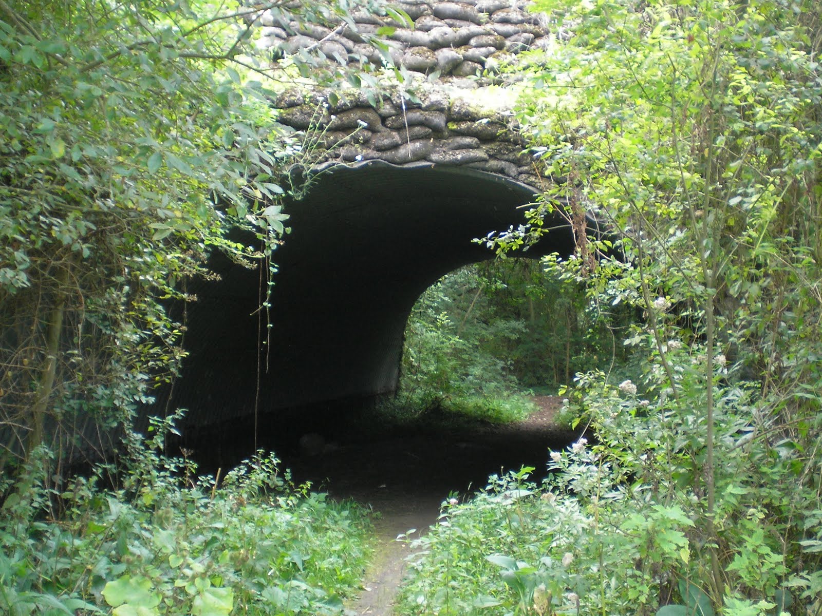
Eventually the path goes under the Eastleigh-Fareham railway line via a pebbly bridge, and bypasses Eastleigh itself. The town was built almost entirely on the back of the railway works here, and although one can't see them from the river the builds are still largely terraced workers' houses and industrial-age public buildings. The leafy riverbank avoids most of the waiting ballast trucks and auto wagons and instead heads for the the suburban park.

A quick loop under the London main line and back again, and open countryside reappears, albeit with the railway close by. The Itchen Navigation is almost dead straight for several long sections here, with only the occasional kink or wobble at bridges on minor roads. The original river veers whimsically off into villages and over fields, returning periodically to its parent like an inquisitive child.

Presently the footpath crosses to the western bank and gets very close to the railway line on its embankment. This is Shawford (the main village is some way to the east) with its station on a brick viaduct. There's not much that stops here, even at peak hours, so I had time to wander around a little, lucky as the only ticket machine is well hidden. There are some delightful cottages by the minor river channel and a pub, and going under the railway lines leads to a sloping area of open land, on the other side of which is the M3. The motorway has had a rather considerable effect on the landscape from here, and there's no avoiding it, as we shall see.
And tomorrow, we'll be going the rest of the way to Winchester.


And tomorrow, we'll be going the rest of the way to Winchester.
No comments:
Post a Comment