Part Three: Winchester - Source (Hinton Ampner)
Winchester is not a large city, and on the last bit I got through the truly urban bit of the river in not much more than ten minutes. Where I stopped was the last bridge in the city, at Durngate, and from here on the river starts to head east in a big, lazy curve back on itself. By the end of this last section I'll be pointing at Portsmouth, and in fact as another trail called the Wayfarer's Walk starts to dip in and out of the IW a few miles from its end, following it there is a conceivable end.
Having been chaperoned through the city, the river resumes sprawling all over the place in several different channels through the area known as Winnall Moors. The Way is still under-signposted whilst in the suburbs (and I wasted ten minutes finding how it went through some cul-de-sacs) but gets going again across a field and past an industrial estate next to a larger channel. At a sharp right I had to duck under a low bridge carrying the A34 and A33, and then through some more woods and fields with the M3 on the right. Presently I came across three other walkers hesitating at a less-than helpful signpost which simply read 'Public Footpath' on three different fingers. We pointed each other in the respective directions we had come from, and I set off again over what was effectively an island in the mass of river Itchens, over several small bridges and into a hamlet full of thatched cottages and Range Rovers. The Way actually has to follow the main road for thirty seconds due to the palatial residence of somebody who has bought a patch of riverside and kept everyone else out. Possibly the reason why the plot of land was more affordable than some is that not long after, the river and the footpath pass in rather uninviting tunnels under the M3.
 |
| Bridge over the Itchen near Martyr Worthy |
 |
| Church of St Swithun, Martyr Worthy |
 |
| View of Alresford and the Downs from Tichborne Hill |
A couple more woods and fields and I had reached Cheriton (and its adjacent settlement New Cheriton), the last villages on the river. Those with a knowledge of 17th-century English history will recognise the name from the Civil War battle that took place there in 1644 (a definite win for the Parliamentarian forces) although as one might expect there's little to be seen of it aside from some notice boards detailing the build-up and troop movements. Cheriton itself is another typically well-kept Itchen Valley village; a few thatched roofs, red phone box, medieval church and tiny brick arch bridge. I had to hurry down a narrow pavement-less bit of road alongside the river in order to reach the 'New' half of the village, by which time the Itchen was looking more like a garden feature (although still with enough water to flow, and support some pond skaters) than a watercourse. It goes underground a short way from the A272.
 |
| Notice on the bridge, Cheriton |
The last mile of the Itchen Way has little water in evidence. Down Kilmeston Lane there is a ditch on the right which has the occasional patch of damp ground, but little else to suggest that here was the river that had been a reasonably-sized watercourse only a few miles away and big enough to sail ships up thirty. The path ends rather unceremoniously at the corner of Hinton Ampner estate, a National Trust-owned house and gardens, although there is no way in from this point (actually, I did contemplate climbing over the fence as I am a NT member and therefore wouldn't be cheating them of an entrance fee, but there were people looking). As mentioned, this spot is also passed by the Wayfarer's Walk and I could have followed it to Portsmouth or Basingstoke if I'd not come so far already. Instead I walked round the far side of the property, past the chapel and across the front lawn back to the village where I'd left the car. And then I drove back to the Itchen, only in the suburb of Southampton where I live.
Advice and information (if you want to do it yourself):
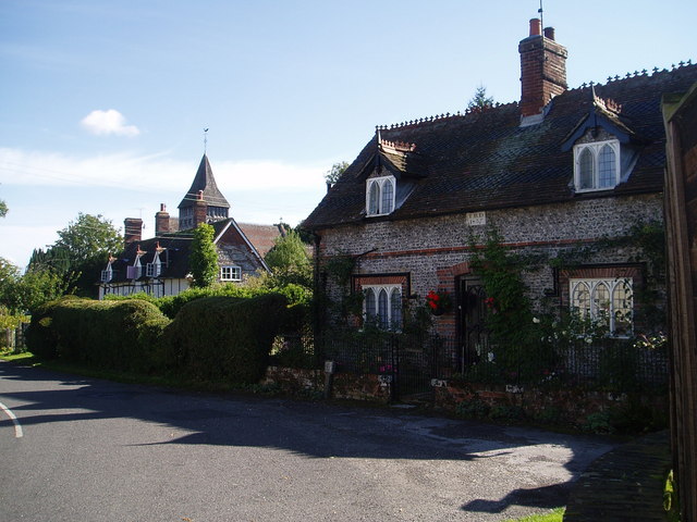
 |
| Hinton Ampner |
I am unsure as whether to recommend starting at the source or the end of the river. Starting at Woolston means that the first few miles are through some rather unattractive urban streets and the river becomes rather diminutive outside Southampton, but you will end in peaceful countryside. On the other hand, starting at Hinton Ampner has the advantage of having rather nicer scenery to start with and ending at the sea, but not much river for the first hour or two. On balance I would probably go for the latter but there are advantages to both. Although it is probably fine, I would advise a little care when walking around the Itchen Bridge and Peartree Common as this area is rather run down, and drunks and groups of youths sometimes hang around.
Note that the actual course of the Itchen Way is at times fluid (and not just because it can get muddy after heavy rain), and that it must be one of the few footpaths about which there is disagreement about where it both begins and ends. There is a waymarker at the south-eastern corner of Hinton Ampner which matches the green line on the OS map, but according to the same OS map the 'Source of the Itchen' was half a mile back to the west on Kilmeston Rd. Other reckon differently. The end of the trail is shown as Sholing station which would mean the Way doubles back on itself, but Wikipedia claims this is just an extension and the Itchen Way ends at the corner of the Itchen where it meets the Solent. Between the A34 and Ovington there are several possible routes depending on how many times you want to zig-zag back and forth across the bridges. The 'official' route is the one I took above, going into Easton and Itchen Stoke, but you could easily cut these few corners and still be following the Itchen as the Pligrims' Way, King's Way, St Swithuns' Way and Three Castles Path all take subtly different routes in this area, as a look at the OS map will show.
A detour up St Catherine's Hill is well worth it, especially now a flight of steps has been constructed to the summit. You can see the whole of Winchester and all the way back to the Solent on a very clear day. Winchester itself is worth an explore too, although please note that the 'round table' on display in one building is a Victorian replica and was certainly not used by Lancelot et al. Also, contrary to what some people may tell you, the statue with the sword in the High Street is King Alfred - the Great - and not King Arthur!
Between Southampton and Winchester public transport is easy, and in fact the placement of stations splits the trail up into convenient sections. Shawford and Bitterne stations are right on the Way, and Woolston is pretty close by too. Winchester station is slightly further away but the walk round the edge of the Roman city, with views of the cathedral, is not really one to complain about. Swaythling, Eastleigh and Southampton Airport are not particularly helpful as they are all but inaccessible from the trail due to airports, car factories and railway works in the way, although you will probably change at the Airport to get to Shawford from the south on a local. Note that when the occasional long-distance train does call at Shawford, only a single door is opened (usually at the front) so listen for announcements and position yourself accordingly.
North of Winchester the railway was removed by Dr Beeching and the Mid-Hants preserved railway (connecting to mainline at Alton) is rather a long walk away, so you are reliant on buses (or an obliging friend with a car...). There is a conveniently-placed bus stop right outside Hinton Ampner, and No.64 services also stop at Ovington, Itchen Stoke and Itchen Abbas along the B3047. These all go to Winchester in the west and Alresford or Petersfield in the east. At the time of writing a large poster is up at Itchen Stoke from the local councillor, campaigning to stop the reduction of services, and even at current frequencies there is not necessarily a bus every hour, so check on Traveline before you go out. I find it is often a better plan to get a bus journey out of the way at the start, and walk back to the station or wherever you parked, rather than have to watch the clock all day and go flat out to arrive somewhere at a particular time.
More information: Wikipedia; Wikipedia on the River Itchen itself;
A very detailed guide with pictures and map from britishwalks.org
No comments:
Post a Comment